Tag Archives: NWS

Videos: River Gauges, Roads, Alcohol, and Fire @ LCC 2019-10-22

The longest items at last month’s voting Regular Session were 3 minutes on 5.b. 2020 Census Resolution (due to discussion about the new initially online methods), two minutes on 5.l. Tax Assessment for the Lowndes County School District Bonds (it’s about debt service on ESPLOST), and 1:44 on 5.k. Industrial Authority Bond Issue and Funding (it’s complicated).

The 5.a. FY2020 USGS Joint Funding Agreement, which adds county funding for the Skipper Bridge Withlacoochee River USGS Gauge to the Hahira Little River Gauge the county has been funding since 2009, breezed through.

Below are Continue reading

Videos: River Gauges, Roads, Alcohol, and Fire @ LCC 2019-10-21

Surprise bonds for the Development Authority and Lowndes County Schools, and a turn lane for Wiregrass Tech, plus a new Forestry Ranger about fire, in these LAKE videos of yesterday morning’s Lowndes County Commission Work Session.

The longest item was five minutes about funding the Skipper Bridge Withlacoochee River USGS Gauge in addition to the Folsom Bridge Little River Gauge, by EMA Director Ashley Tye. Valdosta apparently discovered that Skipper Bridge is not in the city limits, so Valdosta will no longer fund that gauge. But the former funding from the Suwannee River Water Management District (SRWMD) plus more from Lowndes County will cover it, if the Lowndes County Commissioners vote for it at 5:30 PM Tonight, after their discussion yesterday morning.

Georgia Forestry Ranger Randy Spell talked about the use of a vehicle in the Rural Fire Defense Cooperative Lease Agreement And MOU.

Second longest was the extremely vague Continue reading

Packet: River Gauges, Roads, Alcohol, and Fire @ LCC 2019-10-21

Lowndes County is adding funding for the Skipper Bridge Road Withlacoochee River gauge to its traditional since 2009 funding of the Folsom Bridge GA 122 Little River gauge. That’s $8,300 and $14,200, respectively, with another $5,900 for the Skipper Bridge Gauge from the Suwannee River Water Management District. The U.S. Geological Survey (USGS) puts in $900 towards each gauge, or $1800 total. Valdosta still funds the North Valdosta Road US 41 Withlacoochee River Valdosta gauge, and USGS completely funds the US 84 Quitman Withlacoochee River gauge.

[OPTIONS: 1. Approve the FY 2020 Funding Agreement]
OPTIONS: 1. Approve the FY 2020 Funding Agreement
PDF

Details are in the Board Packet now on the LAKE website, received Friday, October 18, 2019, in response to an open records request.

The rest of the Lowndes County Commission agenda for Monday and Tuesday is dominated by roads: a resolution on criteria for taking private roads into the county public road system, and resolutions taking in roads within several subdivisions: Continue reading

Valdosta and Army Corps of Engineers in Flood Risk Management Study

First public update since May: Valdosta has had several recent meetings with other governmental groups and has agreed to co-fund a flooding study by the U.S. Army Corps of Engineers.

WCTV has also picked up Valdosta PR 23 July 2013, City Enters Agreement with USACE for Flood Risk Management Study,

The City of Valdosta hosted a Regional Flood Preparedness meeting with the Georgia Silver Jackets on June 25—a continuation of discussions that began earlier in the year focused on regional interests and on maximizing area resources.

Representatives from the cities of Moultrie, Sylvester, Tifton and Valdosta and from the counties of Lowndes and Turner attended the meeting to discuss current and future flood monitoring and forecasting issues throughout the Little River and Withlacoochee River watersheds. These two watersheds are part of the overall Suwannee Basin that is approximately 10,000 square miles in Georgia and Florida.

Among other information shared, Continue reading

Valdosta Plans Flooding Discussions

Valdosta is finally announcing the 11 April 2013 watershed-wide flooding meeting organized by the Army Corps of Engineers.

WCTV yesterday carried a press release from the City of Valdosta; PR which, oddly, does not appear to be on the city’s website. I have added a few links. Prominently missing from the PR is any mention of water quality, the Floridan Aquifer, or sinkholes. -jsq

The City of Valdosta initiated planning discussions recently that brought together representatives from key local, state and federal agencies to seek solutions to a regional flood issue.

The 50-year flood event that occurred in late February, early March 2013 was a vivid reminder of the 2009 flood event that significantly impacted south Georgia. Since 2009, the city has worked to help identify potential causes and the scope and area of the regional flooding that occurred. This information has been shared with various state and federal officials and agencies in the hopes of gaining their interest and support to work together to address the regional flooding. Since Valdosta is located

Continue reading

The Lowndes-Lanier County EF3 Tornado —NOAA

The tornado was an F2 in Lowndes County and an F3 in Lanier. It went west to east, wrote the NWS in Tallahassee. The pictures we posted that day were apparently where it first touched down, and even then it ripped limbs off of trees and broke some off and threw them.

According to the National Weather Service Weather Forecast Office in Tallahasse, Severe Weather & Flooding Event of March 3, 2012; Lowndes-Lanier Co. EF3 Tornado,

The most significant damage of the severe weather event in south Georgia and north Florida was caused by a tornado that moved from just northwest of Moody Air Force Base to near Lakeland, Georgia. The damage was assessed by a survey team from the National Weather Service in Tallahassee. Most of the damage was consistent with an EF1 or EF2 tornado on the Enhanced Fujita Scale. However, the most severe damage — near Boyette Road and Highway 122 — was consistent with an EF3 rating on the Enhanced Fujita Scale. Maximum wind speeds were estimated to be around 140 mph at that location.
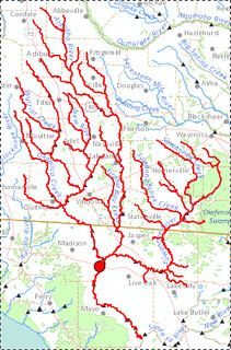
As you can see by NOAA’s map, the tornado was an EF0, EF1, and EF2 while it was in Lowndes County, (as Ashley Tye told the Lowndes County Commission this morning), rising to an EF3 in Lanier County, peaking at 140 mph winds.


View Larger Map

-jsq

Tornado Warning in Lowndes County right now

The National Weather Service map right now shows a tornado warning for part of Lowndes County:

This is at least the second time this month; here another tornado warning for Lowndes County, from 5 April 2011: Continue reading