Tag Archives: Thoroughfare Plan

Still inconsistent, but has speed humps: Lowndes County Thoroughfare Plan 2018

The little-known Lowndes County Thoroughfare Plan drives development in Lowndes County. With no public notice and no public hearing. the Commissioners voted on it Tuesday, April 10, 2018. Probably you only heard that would happen if you looked at their agenda late last week, or you happened to read what I wrote about it Monday.

Lowndes County Road Map

Obtained through open records request, it’s on the LAKE website now.

Like the 2009 plan, Continue reading

To rename George Road, first find it @ LCC 2013-06-24

Commissioners had trouble figuring out which road the County Engineer wanted to rename, and which roads had already been closed, at this morning’s Lowndes County Commission Regular Session.

Commissioner Crawford Powell questioning County Engineer Mike Fletcher


View Larger Map
6.a. Renaming George Road (CR #105)

There are two George Roads in the county and residents want to change the name of this one to Caney(?) Branch Road. There were some questions from Commissioners, mostly about where that road is. Commissioner Crawford Powell kept asking if it was a continuation of Corbett Road. County Engineer Mike Fletcher said no, and the part of Corbett Road Powell was thinking of was closed. Apparently the Commission has closed so many roads even the Commissioners can’t keep track of which they are.

If the Commissioners, with their packets in front of them, were confused, Continue reading

Widening Old US 41 North: It’s Back, for $8 million T-SPLOST!

Lowndes County wants $8 million T-SPLOST to widen Old US 41 North from North Valdosta Road to Union Road, and the map shows the entire road to the center of Hahira as part of the plan.

Back in 2009, a local citizens group called car41no managed to fight off widening Old US 41 North all the way into Hahira, at least temporarily. Well, it’s back! This time, instead of asking for general GDOT money, Lowndes County is asking for funds from the proposed T-SPLOST one cent sales tax.

What is in the plan for old US 41 North between Union Road and Hahira?

It is proposed to construct bike lanes and possibly sidewalks throughout the project for the residents of this area to use.
I suspect “construct bike lanes” means paint lines on the pavement, and note that sidewalks are just “possibly”.

So what is this plan really for? Continue reading

Skipper Bridge Road bridge, Withlacoochee River

The old bridge got condemned during the great flood of April 2009.

Lowndes County is rebuilding the bridge over Skipper Bridge Road near the new school site. I think this is using FEMA funds.

It’s not clear that the new Staten Road bridge is high enough Continue reading

Transportation Plan Open House, MPO

The Valdosta-Lowndes County Metropolitan Planning Organization is holding an open house about its Long Range Transportation Plan. (Not to be confused with the County’s Thoroughfare Plan, which has little or no open process.) This Transportation Plan I think will include another attempt to design a bus system; we’ll see. I’ll be there; how about you?

Here’s a transcription of the PDF flyer:

PARTICIPATE! PARTICIPATE! PARTICIPATE!

Public Open House

Wednesday, February 17, 2010
3:00 PM to 5:00 PM

at the
Southern Georgia Regional Commission
327 W. Savannah Avenue, Valdosta, GA

2035 Valdosta-Lowndes MPO
Long Range Transportation Plan Draft Project List Review

Valdosta-Lowndes MPO
229-333-5277 … chull@sgrc.us … www.sgrc.us/transportation

Planning Opportunity: Lowndes County Thoroughfare Plan

John S. Quarterman
3338 Country Club Rd #L336
Valdosta, GA 31605
25 January 2010

Ken Sherrill
Chairman
Greater Lowndes Planning Commission

Dear Chairman Sherrill,

Congratulations on the new proposed amendments to the Comprehensive Plan and on the process by which they were produced. Any public plan can be improved by external input and public hearings, as changes to the ULDC and to the Comprehensive Plan continue to demonstrate. Planning for the entire county can reduce mismatches of effort and promote development close in to existing services while perserving neighborhoods, agriculture, and wildlife.

I’d like to bring to your Thoroughfare Map, Lowndes County, Georgia attention another opportunity for improvement. Lowndes County has a Thoroughfare Plan whose author says it "works as a guide for development and potential use changes in property." This is the same purpose as the Comprehensive Plan, so it should be of interest to the Planning Commission.

The county lets contracts for road work based on the Thoroughfare Plan, and as the county says, once a road is paved or widened, it can support denser use. Some of this road work is in areas Continue reading

Thoroughfare Plan for Lowndes County

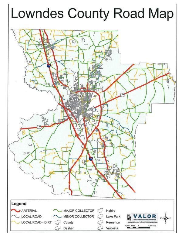
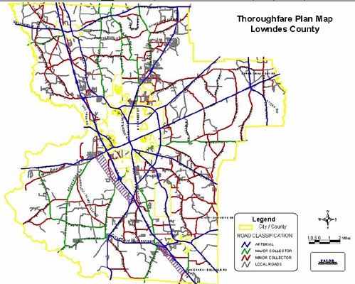
Lowndes County is proposing to update its Thoroughfare Plan. The current one was approved in 2003. The draft sent Friday by the County Engineer to the Commission for approval today is here. In addition, here is the county’s Road Inventory. The first of these items is available on the Lowndes County web pages. The other two items don’t seem to have been posted there yet. These public documents paid for by tax dollars were obtained through public records requests and are being posted by LAKE as a public service.

Thoroughfare Map, Lowndes County, Georgia

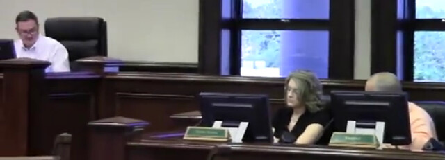
In case you haven’t heard of the Thoroughfare Plan, it was described by the County Engineer during the County Commission’s work session yesterday morning as

…works as a guide for development and potential use changes in property.
Here is the Valdosta Daily Times report on that meeting: “Thoroughfare Plan sparks lengthy debate,” By Malynda Fulton, 9 Oct 2009. She writes that:
The Thoroughfare Plan, first adopted in 1983, is used as a guide for road improvement projects, private developments and land use changes.

The “20/30 plan” referred to in that newspaper article is the Greater Lowndes 2030 Comprehensive Plan developed in conjunction by the South Georgia Regional Development Commission, the County Commission, and the Valdosta City Council. Its purpose is:

The Greater Lowndes 2030 Comprehensive Plan is a road map for ensuring growth and development in the Greater Lowndes Communities occurs in a way as to maintain our quality of life and unique community character.
It’s quite interesting that both plans are intended to guide development, yet they recommend opposite outcomes. 
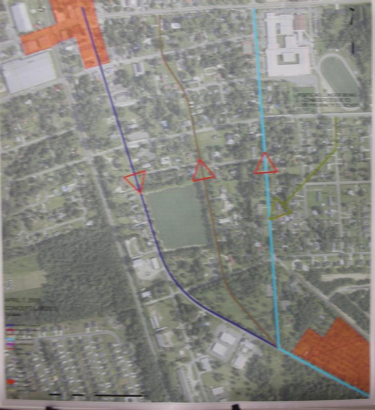
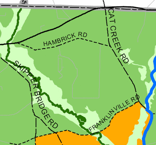
In particular, the justification given at the meeting for the proposed reclassification of Quarterman Road from local to minor collector was that “if it were developed” within 20 years there would be enough trips to justify such a classification. Yet the Comprehensive plan shows the same area as agricultural through 2030:

Detail, 2030 Lowndes County Future Development Map

Perhaps better coordination is needed. Fortunately, the Chairman and the County Manager appear to be soliciting input.

The scheduled vote on approval of the new Lowndes County Thoroughfare Plan is at the regular Commission meeting at 5PM today, Tuesday 10 November 2009, at 325 West Savannah Avenue (near the water tower).

This blog post by John S. Quarterman.

-jsq