Update 2021-11-08: Videos: Comprehensive Plan Update Public Hearing 2 @ LCC 2021-10-26.
All of the speakers at the Comprehensive Plan Stakeholder Meeting were opposed to moving the Suburban Area line farther north on the Character Area Map. They presented cogent reasons, such as they live up there and aren’t going to sell, there are already 750 lots available for sale while it took a decade for Nelson Hill’s 500 lots to sell, and the county should be looking out for its people and preserving much of the county for the next 50 years.
![[Comprehensive Plan Update, Crowd, Lowndes County Character Areas, Map of those opposed to changing Character Areas]](http://www.l-a-k-e.org/govt/loco/2021-09-28--lcc-comp-plan-videos/many.jpg)
Most of the Commissioners acted like further development northwest in the county is a force of nature over which they have no control, and expressed more concern for developers and investors than for the room full of people in front of them or the 900 petition signatories opposed.
Here are links to each LAKE video of each speaker with copious notes, followed by a LAKE video playlist. There was no agenda. The lowndescounty.com online calendar had only a title, Comprehensive Plan Stakeholder Meeting, date, time, and place, with no agenda. The draft minutes are sketchy, omitting key points such as the Dorfman report, but you can find that report below.
-
Presentation and some comments
Video. Presentation by JD Dillard (0:16 – 3:37)
Kathy MacMillan Adkins (3:38 – 9:07)
Brad Folsom (9:08 – 31:17)
Commissioner Demarcus Marshall and discussion (31:18 – 36:56)The keyword is “grow”, as in sprawl. As County Planner J.D. Dillard said, “that’s kind of why we’re here tonight,” after he read this from the bottom of “Future Land Use Character Areas”:
“As the community gains a greater understanding of the role and value of character areas, their descriptions should be fine-tuned. Additionally, as the community continues to grow, specific character area depictions may need adjusting.”
![[06 Future Land Use Character Areas]](http://www.l-a-k-e.org/govt/loco/2021-09-28--lcc-comp-plan-videos/06-future-land-use-character-areas.jpg)
06 Future Land Use Character AreasThe County Planner said we were there particularly to discuss Agricultural Areas, Rural Residential, “and again moving forward into some of the Suburban Areas, and how we continue to look at the county’s growth.”
No copies of the draft plan were distributed. County Planner J.D. Dillard said it was online on the county’s website, but it is not under OFFICE OF THE COUNTY PLANNER, where there is only a copy of the update from 2016. Searching for “Comprehensive Plan Update” finds 2021 Joint Comprehensive Plan Update For Lowndes County & the Cities of Dasher, Hahira, Lake Park, Remerton, and Valdosta, 9/9/2021. A search on sgrc.us finds the same file. Neither file includes the character area maps, even though there was one in the front of the room and another in the slides.
![[Map: Lowndes County Character Area]](http://www.l-a-k-e.org/govt/loco/2021-09-28--lcc-comp-plan-videos/07-map-lowndes-county-character-area-map.jpg)
Map: Lowndes County Character AreaHowever, upon request, the County Planner sent the Unfinished Lowndes County Character Area Map, with this explanation:
The map presented during the September 28th meeting was the Character Map from the 2016 Comprehensive Plan. The colors might have been slightly different from the printed hard copy, but the information was the same.
The SGRC created a map for me that I used in the PowerPoint presentation (attached), that used the 2016 Comprehensive Plan Character Areas with the Approved TSPLOST Paving Projects, and the Current Lowndes Utility Locations. There were several slides in the presentation that were simply zoomed in portions of the attached map, for the sake of legibility.
![[North Lowndes County Character Areas]](http://www.l-a-k-e.org/govt/loco/2021-09-28--lcc-comp-plan-videos/12-hahira-character-areas.jpg)
North Lowndes County Character AreasThe Draft 2021 Comprehensive Plan available on our websites does not contain the Character Maps for unincorporated Lowndes County, as they have not been created yet.
The hard copy map [in the 2016 Update] showed the Urban Service Area in a curvilinear red outline.
The map presented in the Stakeholder meeting did not have that line as it cluttered the parcel outlines. Instead, the current water and sewer utilities were shown.
To my knowledge, that line has not change[d]. I would defer to the GIS department at the Regional Commission for confirmation.
In addition, Elizabeth Backe of the SGRC sent the completed Character Area Maps for Hahira, Dasher, Lake Park, Remerton, and Valdosta.
All those Character Area Maps are included at the end of this post.
-
Kathy McMillan Adkins
![[Honor our heritage --Kathy McMillan Adkins]](http://www.l-a-k-e.org/govt/loco/2021-09-28--lcc-comp-plan-videos/13-adkins.jpg)
Video. She thanked the Commissioners, then:
In preparing these maps, I am amazed by the numbers of subdivisions going up on Val Del Road. Clyattstone Road, all the way to Highway 41. The destruction of our rural lands is very disturbing. I have not spoken of anyone who is in favor of the tidal wave of these subdivisions, and the rezoning of our rural residential areas to suburban. With the exception of one person who is in favor. The impacts of these massive developments are not yet known, in many many aspects.
Most everyone repeated the same thing, and that was, if we wanted to live in a suburb, we would have built or moved to the suburbs. When these agricultural areas are gone, and farmers are no more growing our crops, where is our food and our clothing going to come from.
Concerning the water pipe planning to be run up to McMillan Road from Lucas-Richardson Road, the only advantage this will serve is to the investors and the developers. For the 64-acre tract that was recently withdrawn on Val Del and Bethany Drive, this will cost $550,000 in SPLOST money that has been paid for by the Lowndes County taxpayers. This is a waste of taxpayers’ money. This will only benefit the developers. So if you are expecting a return on investment you are going to be very disappointed.
There isn’t anyone on McMillan Road willing to sell their land. Not anyone. This land has been in my family for seven generations. The land on Val Del and Parker Place has been in my family for seven generations. I’m talking my mother and my father. So, in the future, if you’re planning on running water and sewage lines down McMillan Road, you will have to go several miles down McMillan Road to find anyone to sell to developers and investors.
In collecting these signatures for our petitions I have listened to everyone’s concerns as evidence by my neighbors who are able to attend the meeting tonight who sit behind me. We have collected over one thousand signatures. We have petitions signed, we have evidence.
We respectfully ask that you honor our heritage, our decades-long hard working of our lands, and keep the 2016 Comprehensive Plan, Zoning Plan in place, allowing for two and a half acre lots only. I respectfully ask for common sense to be used in this vote, not financial gain. And I thank you for your time.
Any questions?
The Commissioners had no questions.
The Minutes only say:
Kathy McMillan Adkins, 5224 McMillan Road, addressed the commission in opposition to changing the existing character area map. Ms. Adkins thanked the Commission for their service to our community. Ms. Adkins stated no one on McMillan Road is willing to sell their property and she has land that has been in her family for over seven generations. Ms. Adkins asked the commission to keep the 2016 Comprehensive Plan in place.
-
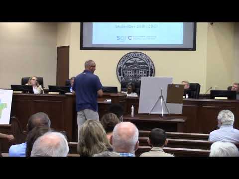
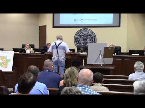
Brad Folsom
![[Brad Folsom]](http://www.l-a-k-e.org/govt/loco/2021-09-28--lcc-comp-plan-videos/14-folsom.jpg)
Video Brad Folsom thanked the Commissioners for “going back in the process a bit.” Then:
However, you know, we are at somewhat of a disadvantage, I think, because, we don’t know what is being proposed, or even thought of, by the Commission. We have, as he mentioned, a draft of the Comprehensive Plan, but that draft doesn’t contain any maps of changes to the character areas. So somewhat of what I’m saying tonight is a little bit based on supposition and word of mouth, which is not good things for the Commission, the county, or the residents. So I would encourage you all to put out there, either tonight or soon, what it is you’re thinking of, so it can be addressed as well.
But I’m here representing a group of concerned home and landowners, most of which you’ll see on this map. I wanted Ms. Adkins to leave this up here, because this map shows you just how pervasive the sentiment is about this issue in north Lowndes County. And these are, not that you need reminding, about a thousand residents in that area, and most of the land mass in that area, are represented on this map.
And uh, you know, I don’t think any of the folks in the group I represent want to be necessarily no, never, and not in my back yard folks. They want to come to the table; they want to get something that will work for everybody.
But they also at a premium want to protect the lifestyle that has been guaranteed them by the things this commission has done in the past. Maybe before some of you were on here, or whatever. But they want that protection. As Ms. Adkins mentioned, 900 folks signed the petition when we were here for the Bethany rezoning that was withdrawn. Since then another 100 or 150 or so have added their names to that petition. …the wording says that they would like the same thing: the rural residential character area of this particular area.
I want to talk a little bit about the things we can all agree on. First of all, between North Valdosta Road and Lucas-Richardson Road is approximately 750 lots as we sit today, by Mr. Dillard’s count, ready for development. Already developed, I should say. They are ready for sale and ready for building. That’s vacant land. There’s also several tracts of land that owners who, NATCO, the Dasher … Corporation, all those groups have their land for sale, ready for development. This is all south of Lucas-Richardson Road, which is where, as you know, the county’s water and sewer ends at this point.
One key point that we’ve talked about a good bit is the Val Del Road capacity, as you may know, is 6,000 cars per day. In 2019 it was at 4,950. As you all know if you’ve been down Val Del Road, how many houses have been built since then, and how many cars are coming down that road. I would venture to say that we’re pretty dang close to the 6,000 cars per day now. This will only, any changes to that will only add to the issue. And as we’ve been told, any changes to Val Del Road are in the 2026 area, five years from now. So that’s a long time to deal with possible issues that are already present.
I came down Val Del the other morning just as a sort of test run at 7:30 in the morning and I sat at that red light through three changes of the red light at North Valdosta Road to turn left. That’s an onerous burden for somebody living out there. I don’t know if any of you live ut there; I don’t think any of you do. But you ought to go down and come through that way. That’s not a good thing for a resident.
You know this chart shows very clearly the folks who are against this type of small lot development.
And one of the other things we did, just today, was we took an area from Union Road on the west to the [Withlacoochee] River on the east, bounded by Lucas-Richardson on the south, basically the existing rural residential character area, and on the north by Thompson, Bethany, McMillan. I think it’s [something] to know that area counts as 6,250 acres approximately. And again, we’re going on supposition.
But what we’ve heard is that you’re thinking of increasing the suburban character area up to McMillan and up to Bethany Road. But you’re increasing that area almost 6,300 acres. That’s a lot of land to be developed that there hasn’t really been shown to be anybody in favor of that live in that area now. And this encompasses right at 80 to 85% of the land area of the people that signed this petition.
And I know in a perfect world, and I’ve said this to many of you, we would encourage density closer to urban areas, that’s the ideal decision here. And I think it’s left up to you, and I’ve thought this ever since I was on the Planning Commission, before we had the meltdown in 2008, our banking community did a lot of this for us. You know, they determined where development ought to go, by the loans they made. I know for a fact that doing this type work with banks these days that a lot of those banks are more focussed on the amount of business they write rather than making these decisions.
That leaves the decision to local government. It lands squarely in your lap and the Planning Commission’s lap. I want you to take that as very important.
You know I think that we would all encourage smart development in our community, and not let development be driven simply by what non-resident or non-local in some cases developers and others want to do. That’s not the pattern for economic growth. The pattern for economic growth is protecting and densifying near urban areas, not moving into rural character areas.
I’ll end by this. As I said, we’re not here to say no, never, not in my back yard. I want you to consider a few things… I’ve said it to some of you, I’ve said it to J.D. a couple of times. There is very easily, it may take some more times, more effort, but there is very easily created a new buffer area, a new character area that would be a rural suburban buffer area that would not allow for different size lots, that would not allow for different development standards, that could shelter some of the development that’s occuring south of Lucas-Richardson and between this area that we’re thinking about expanding into. I think you could easily do that with development standards and increase the development standards within the ULDC.
I think you ought to consider focusing water-sewer expansion rather than down McMillan, as we’ve heard, up Staten. If you go up Staten, that gets you closer to what I’ve heard is to loop the system for quality. But it also gets you closer to school campuses. It also gets you closer to Moody Air Force Base and the development out Bemiss. All that plays into development that’s already occuring. And not taking away rural areas that ought to be protected.
And as a last resort, if you find that this commission wants to change these character areas, then I think that you very, you must look very strictly at development standards. You know the last thing we need in this community is to turn into communities that have nothing but rooftops when you ride up to a subdivision. You have to make sure that we have some development standards that require a more sophisticated type of development in this community. And not the lowest common denominator of laying roads and utilties and [inaudible].
So I hope you’ll consider that. We’re happy to continue to work with the county and the commission on all these; happy to come to the table and try to work through some alternatives. But I want you to very much know there is a large group of people, a large group of homeowners, landowners, and voters, who are absolutely against what we are hearing.
Thank you, and I’ll be glad to answer any questions if I can.
Commissioner Scottie Orenstein said there are things they would disagree on.
I’m not being defensive, but I kind of understood what you are saying is that we are letting developers drive our growth. Is that what you said?
Brad Folsom answered:
Yes. And I didn’t say it [inaudible] way, I said non-resident. What I meant is developers who don’t live in these areas coming in and buying property and convincing people because they can sell their property for more than rural and land uses they can come in and develop it. Everybody surrounding does not want that.
Orenstein continued;
So, the challenge, though, Brad, is it’s not where the development’s going to be. The developers are not going to develop land, the landowners are not… Let’s back up. The landowners are not going to sell property that a landowner can’t buy that a builder can’t purchase lots in that an end user ends up zoning in. In my opinion, it really boils down to that’s where people want to be. I mean, we won’t name any specific developments, but we all know of some that everybody seems to say, we don’t want any more of these. I publicly said that I didn’t want any more R-10 and we had to be really thoughtful about where we allowed any more R-10. But really, it’s where people want to go. So I mean really, this group of folks will say, and you said a minute ago, you ought to focus your efforts over closer to Staten. Well you’re going to be right back up here with a group of folks who live on Staten Road and that side of Skipper Bridge and all that, if that’s the case. I mean, it truly is not in my back yard type situation. And I’m very empathetic to everybody here tonight. …I agree with a lot of what you said. But as somebody who passionately cares about our community and doesn’t want to be like other communities that’s been discussed, where they’ve said, we’re not encouraging any more growth here, we don’t want it, stay away, and some of those people are struggling here twenty years later. So we don’t want to be known as a group of commissioners who’ve said that, you know, absolutely not, developers stay away from here, and everything’s going to stay the same, we’re all going to be comfortable and peaceful where we’re at, we’re not going to be able to change.
So, how do we find that balance? Especially when everybody wants to be from North Valdosta Road to Bethany Road? And I’m saying all the way left to right, east to west. I mean, that’s where the growth is occuring. So how do we?…
Brad Folsom responded:
Well no, I get that. I think the thing that lets the air out of that argument a little is the 16 hundred 70 acres that NATCO owns that’s ready for development. The two or three hundred the Dashers own that’s ready for development. All in that area. You know that inventory alone, you develop those two tracts….
Scottie Orenstein interjected:
But we’re not the developers!
Folsom continued:
I understand, I’m venturing a little here, because I don’t know, but I would venture to say that the developers who have approached NATCO and Dasher don’t want to pay the prices for those, but will pay the prices that a tract on Bethany or whereever, probably a lower price. That’s pure speculation on my part. But what that tells me is, what sort of lets the air out of that argument, is that that land is plenty in that area, in the exact area you’re talking about, for development for the next ten years, or fifteen years. We already have 750 lots today that are ongoing. 750 between North Valdosta Road and Lucas-Richardson Road. Add 1600 acres development. What does that give you? Three times that? Four times that? Tell me there’s going to be 2100, 2500, 3000 more houses built in the next ten years in that area. I don’t personally see it. Our population went up 5, 7,000 in the census?
Scottie Orenstein interjected:
We’ve all said we don’t know. I would love to know where the people….
Folsom continued:
I would venture to say, and I’ve said this to some of you and everybody in the room probably already knows it, I can’t also see that we won’t have another economic downturn in the next five years. And none of us can. But you kind of have to put that into your equations.
Commissioner Clay Griner spoke up.
Here’s a way to look at it. Starting with the 1920 census, every forty years Lowndes County has gone up 80 to 90% in population. So if you’re at 100,000, forty years later you’re going to be at 180-190,000 people. So we just had 119,000 in the last census count. So by 2060 you’re going to have about 215,000 who live in Lowndes County. Where are they gonna go; where are you going to put them. The city grew 800 people over the last ten years. Not the city. It’s going to be unincorporated area. Property is where they’re moving to. So….
Brad Folsom replied:
Of course we know the larger issue this entire community has to deal with is people, the tax base, moving out of the city of Valdosta. I believe that even though we all talk about getting along, we all talk about all of that, we have to do something about that as the county. And we have to get the cooperation of the city to do that. Brad talking as a county resident.
Giner interjected:
I agree. I don’t disagree with you. I’m just saying….
Brad Folsom continued:
We can’t continue to multiply the county and let our urban area continue to dedensify. That’s not good planning; J.D. says it is….
Griner replied:
I don’t disagree with you. But I’m looking at what the trends are and what’s actually happening. I can say I would love for everybody to move inside the city limits of Valdosta, but that’s not what’s happening. That’s not what happened in the last ten years.
Brad Folsom replied:
And all we’re asking is for this commission to find a way to reverse that trend, or at least to try to stem to tide. And not just continue to add and add and add and take away from our rural areas.
Griner replied:
I’ve looked at the numbers, and so by 2060 we’re going to have 215,000 people in Lowndes County, and there’s got to be growth somewhere.
Scottie Orenstein added:
And I don’t think they’re gonna grow, the city of Valdosta, is going to grow, and this is just my opinion, I don’t think they’re going to grow within their city limits now. So then what are you talking about: annexing property on the other side of the bridge towards the north end? The same thing’s going to happen then, and maybe even more densely populated than what we’re talking about. I don’t know, it’s been nice…
Brad Folsom replied:
I don’t know. Nobody has a crystal ball.
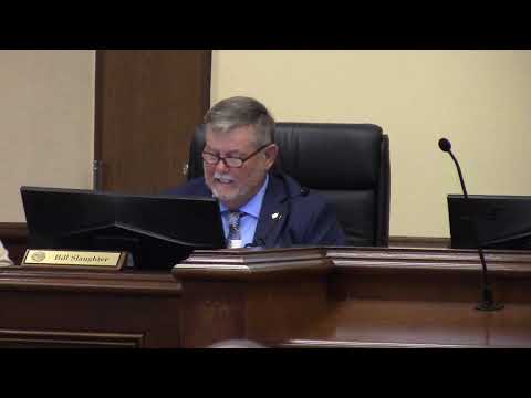
Chairman Bill Slaughter complimented Ms. Adkins for her presentation, then:
However, she made the statement she never intends to sell any of her property that’s there. There’s nobody out there, regardless of where this imaginary line ends up, there’s nobody twisting anybody’s arm to make them sell, the acreage that they have. That’s a decision that those individuals make, that they want to market their property whether it’s a farmer that’s looking for a retirement strategy or whatever it may be, and then on the other hand you have a developer who recognizes the fact of where that growth if at and he makes that investment to figure to that I’m going to gamble on this and see if I can put a development in here and then sell these properties. We know, as you said, a downturn turns in the market, all this is not really going to matter until it make another adjustment, but reality is, as we’ve said, we have a responsibility as well as to be able to look at this growth patterns that we have before us at present so that we can make the adjustments.
And I say this a lot of times, we never want to get in a position where we’re actually chasing development, we’re chasing growth in this county. We need to have the foresight to try to have some planning in place, so that if it chooses to go somewhere and in that direction, we’ll be there and basically be ready. So that’s, you know, it’s a very very tough decision that everybody’s going to have to make.
But again, I just want everybody to understand, as much as anything, that the Comprehensive Plan also is a tool to use. It’s not anything that’s etched in stone that says you do this and you do that and you don’t do this. It’s a tool for everybody to look at. It’s a tool for the developers to look at: where’s their potential for growth. It’s also has to do with other investors who maybe just want to go out there and make an investment in a piece of property. All of those factors play a role.
At the end of the day, as we look at the Comprehensive Plan, we’ve got to be conscientious enough about the fact that currently, as it sits, Lowndes County unincorporated is growing. As we’ve said, where it’s growing is in the north and northwest side.
And that has a lot to do with the school. I’ve got grandchildren that’s in that school. And everybody wants to be in that school system.
Now, the schools themselves are going to have to make some decisions from that standpoint. Because again they can’t tell people not to move into that district. What will they do? They’ll adjust district lines, make a decision to add on or build a school. They’ll do what they have to do. And that’s the message that I’ve received: don’t worry about the school system; the school system will do what they want to do. But at the end of the day as [somebody] kind of said, we’re faced with challenges that folks want to live in this area.
So I agree, and Scottie, Mr. Orenstein touched on it, you know, we don’t want to see everything annexed. We just don’t. We got some of that, and we want to move on away from that. I agree with a lot of what’s been said. But this is a challenge.
It is something that we’ve got to at least take a look at the next five years, minimal, of what we’re going to do, of what we’re going to be looking at. Because we’ve got to give everybody some direction; everybody needs to understand where we’re headed. That responsibility does fall on us at the end of the day.
Brad Folsom replied:
Mostly I’d like to say you keyed in on it just then, is you look at this Comprehensive Plan every five years. And quite frankly I understand what you’re saying about it informs the process but necessarily bear on the process. But your ULDC reads a little more strongly than that. And since you look at it every five years, if you’ll think about, just think about the development pattern of Nelson Hill.
Nelson Hill began being developed around 2008, because I foreclosed on it in 2009. And it’s got roughly 500 lots, if I remember right. It’s taken about ten years for that to be developed. So that’s 500 lots. We have 750 now. You’re going to look at this again in five years, right? So let’s leave it the same and see where we are in five years. Because you have 750 lots now. You have two or three other tracts in this area that will be developed. There’s really no reason to move it beyond that. If you want to put water and sewer in, if you have the capability and the money, put it in. But let’s look at it. Because once the character area is changed, I can tell you, representing people who are against zoning changes, your back is against the wall. You have virtually no say-so.
Commissioner Orenstein interjected:
That’s not true. If that were the case we wouldn’t even need to be here….
Brad Folsom continued:
But your duty is to follow your zoning ordinaces, your ULDC, and your character area maps that you’ve passed. That’s your duty as a Commissioner. It’s the law. So once you pass it, you’re upholding the law, and it makes it incredibly hard for anybody opposing it to go in any different direction, if it fits within those character areas, if it fits within the ULDC. I can tell you, if I challenge zoning, ti makes it really hard.
So I think there’s a good opportunity to leave it as it is for five years.
Commissioner Demarcus Marshall said he had a general concern:
In looking at everything in red, that’s a lot of money that’s already been committed. I stopped at $10 million of roads that we’re talking about putting in this area. A long story short, just by putting paved roads and infrastructure in those areas, is going to create traffic and what have you. We talked about the wastewater and what have you out there. This money has already been obligated as part of this process. And the problem I’ve been finding is, under natural or normal considerations for paving a road, when I drove those areas I didn’t see many houses. I mean they were separated. But this is a $3.7 million road that is going to be paved. This is a $2.5 million road that is going to be paved. Is there any way we can take it off the list? By guarantee it’s already done, right?
“It’s done,” interjected another Commissioner.
And so you’re talking about the next five years and this band three, no matter what decision is made, you’re talking about paved roads on Hall Road, all those major roads, and that’s going to put traffic through that whole area. My concern is about I want to know can we use the money elsewhere. If not, what we’re talking at the endMy concern is about I want to know can we use the money elsewhere. If not, there’s going to be traffic in that area. There’s going to be a lot of growth. You’re talking about already development decisions have been made since the water came in. I don’t know if you can almost turn this around, because of the amount of money that’s already been obligated and voted on.
Chairman Slaughter replied:
Well, I would say, Mr. Marshall, that those roads that are on the T-SPLOST agenda, they’re all primarily running east and west. Those roads are going to be utilized primarily by the folks that live in that area. They start at Val Del and go over to 41, then across to Union Road. But that’s going to be roads that citizens that live in those areas will have a better means of moving east and west between those those primary corridors in Lowndes County. Right now, some of the roads we are talking about, Bethany Road is a primary example, of one of those east-west corridors, where folks that’s over on Val Del that wants to go 41 or in that direction, cut across to go over to 41, or they take McMillan and go over to Bemiss. So that’s the purpose of those roads, and that’s really the analogy behind those roads being resurfaced….
Commissioner Marshall replied:
I’m just saying that’s calling for development when you pave like Hall Road, and there’s really not much out there. You’re going to do that road, all the way across, that’s a lot of money for an area that does not want development. And if they don’t want development, and if we say we’re not going to do development, why do we spend money on it?
Chairman Slaughter replied:
What I think what I believe here is that the dilemma here is what I said earlier. There’s folks that live in this area that will never sell their property. Has no intention whatsoever. As was said has been in the family for seven generations. It will remain in the family for another seven generations. But then there’s also some property out there that someone would prefer to sell that. There is some ag lands that fall in that category, where a farmer is looking for his retirement. He’s worked hard for his entire life on that piece of dirt, trying to plow out a living, and he wants to retire, and so he makes the decision that he wants to sell some of that property. Well, again, that’s a decision that individuals make…. Again, we’re looking at it from a standpoint of where do the citizens in this community currently want to live? And I think that evidence is showing every single time you look at it, again it’s in that northwest corner. We can’t put a gate up there and say nobody else in here, because this is where we want to be. And so I do agree that our challenge is, and what we are obligated to do is to find the very best way to make that work for everybody. And again, what we’re seeing here is not something that is in concrete. But it’s something that we have to consider as a starting point. And I believe that we can get where we need to be. That we can address our concerns and this community’s issues for the next five years. And then in another five years, we’ll look at it again, as we’re required, to see what we need to do.
The Minutes only say:
Brad Folsom, 2611 North Patterson Street, addressed the commission in opposition to changing the existing character area map. Mr. Folsom stated the current residents in the area want to protect their lifestyle and maintain the rural character area. Mr. Folsom stated if the commission wants to change the character area, to look at development standards. Commissioner Orenstein stated citizens want to live in this area and it’s sometimes difficult to find a balance to satisfy everyone. Chairman Slaughter stated it is the decision of the property owner(s) to sell their property, if they choose, and the Comprehensive Plan is a tool to use with developers and investors. Chairman Slaughter stated this is a challenge and it does fall on the Commission to make a final decision. Commissioner Marshall asked if taking some of the roads off of the paving list would possibly be a consideration. Chairman Slaughter answered that the roads are going to be utilized by the citizens in that area.
-
Gretchen Quarterman –

My name is Gretchen Quarterman, and I live at 6565 Quarterman Road, which is up that Bemiss [Road].
I’m not a lifelong resident here. I first stepped my first step into Lowndes County in 1993, when Bemiss Speedway was being built. When the road was all tored up and everything was pointed right at my father-in-law’s place. You know, here, come right up Bemiss!
When he was a little boy, they walked when they moved from Valdosta out to the farm, they walked, and it was a dirt road. And now it’s a speedway. And soon 41 is going to be five lanes, it’s going to be speedway from Union Road down. And Val Del has to get fatter, because there’s all these houses out there. Because I live out there, I can come down Bemiss, or I can come down Staten Road, or I can come down Val Del. I come down Val Del a lot more because my daughter and son-in-law and grandchildren have just moved to Bethany Road. So that’s pretty handy for us to have them over there.
Years ago. I think Paige was maybe here then. I don’t know that any of the rest of you were. The commission paid for a study about planning. It was called the Dorfman Report. And the Dorfman Report gave great detail about how much services houses take, and how important it is to have development close to existing services. And the farther out you go, the farther the Sheriff has to go, because trees and cotton don’t call the Sheriff, but neighbors do. And if you don’t have a lot of school busses running out there. So taxes in all of our areas get raised because we have services. I don’t mind paying taxes, but I want to know that my tax money is spent wiseley.
When the Commission was still meeting at Savannah Avenue, and water was being run up Bemiss, in fact all the way up to River Road, a developer came, stood at the podium, and said, “you ran that water for us.” Well I thought that the water was being run for the citizens. I didn’t know that it was being run for developers.
And honestly in the deepest part of my heart, that’s what I feel like you’re doing, when you run water. You just made a ring. You ringed the city. The city can’t get out any more. And the people who live outside the ring, we’re happy outside the ring. We don’t want… People move here for the rural quality of the community.
Now Clay said that population grows, grows, grows, and that’s true. But people that want to live in an urban area, they’re going to move to Augusta, or Savannah. People that move here want to live in this area. They want the slower quality lifestyle. I know that. I know people who have moved here for that reason. So there’s some balance between people are going to move here, and what do we want our community to be.
And that’s what I really want to get to. Are we riding the train? Or are we driving the train? And this map drives the train. And I think we should be very careful how we drive the train. Because we don’t want to just go, well, we did this thing, and that’s where we had to go, because we did this thing, we ran the water up there, and now that’s where we are. We need to think carefully, what do we want our community to be.
Only two weeks ago, somebody stood in this chamber and said, decisions that were made fifty years ago about parks and recreation or historic preservation, now they’re saying, why didn’t those people protect those areas. And in parks and rec I think we’re doing a pretty good job identifying places we want to preserve. But I think in the whole character of our community we want to do that same thing.
In fifty years we don’t want to have people saying, what were those people thinking. Why didn’t they preserve us to be a nice little community. Thank you.
The Minutes only say:
Gretchen Quarterman, 6565 Quarterman Road, addressed the commission in opposition to changing the existing character area map. Mrs. Quarterman stated 41 North would be a speedway and people move here for the rural quality of the community.
The Dorfman Report
 The Local Government Fiscal Impacts of Land Use in Lowndes County:
Revenue and Expenditure Streams by Land Use Category,
Jeffrey H. Dorfman, Ph.D., Dorfman Consulting, December 2007.
The Local Government Fiscal Impacts of Land Use in Lowndes County:
Revenue and Expenditure Streams by Land Use Category,
Jeffrey H. Dorfman, Ph.D., Dorfman Consulting, December 2007.
As Dr. Dorfman summarized in a different presentation,
Local governments must ensure balanced growth, as
sprawling residential growth is a certain ticket to fiscal ruin*
* Or at least big tax increases. -
David Houtz
Thank you for at least entertaining what we have to say here about land use.
I’ll be honest, I’m from North Carolina. I came here in the military in 2000. I met my wife here. We left in 2008. We alway said if we get a chance to come back we will. That’s where we want to retire. In 2015 I had an opportunity to come back. We looked specifically for a rural area….
The Minutes only say:
David Houtz, 5767 Thompson Road, addressed the commission in opposition to changing the existing character area map. Mr. Houtz stated he returned to this area to raise a family and he does not want to have this rural agricultural area destroyed. Mr. Houtz stated the developers will be gaining if the character area map is changed. Commissioner Griner addressed census numbers that Mr. Houtz had questioned.
-
Smith Mehr

Video. The Minutes only say:
Samantha Mehr, 5909 Val Del Road, addressed the commission in opposition to changing the existing character area map. Ms. Mehr stated she’s lived here since 2005. Ms. Mehr requested a copy of the oath of office that the Commissioners took when entering office. The County Manager, Paige Dukes, responded that it is maintained by the state, Ms. Mehr asked if she could receive a copy, Mrs. Dukes responded yes. Ms. Mehr stated she enjoys living in a rural area with her livestock.
-
Neil Allen

Video. The Minutes only say:
Lee and Linda Scott, 5851 Val Del Road, when Chairman Slaughter called on them to speak, they had changed their minds about speaking.
Bill Allen, 5052 Bethany Drive, addressed the commission in opposition to changing the existing character area map. Mr. Allen stated that with the current amount of traffic, by increasing the number of homes in the area, the traffic would only increase and be much worse. Mr. Allen mentioned where he lives is diverse and he’d like to keep the same character area.
-
George Fisher
Video. The Minutes only say:
George Fisher, 5278 Hall Road, addressed the commission in opposition to changing the existing character area map. Mr. Fisher stated he doesn’t want Hall Road paved and he’s lived in the area for twenty years and is against expansion.
-
Meeting Adjournment

Video. The Minutes say:
Commissioner Griner made a motion to adjourn the meeting, Vice Chairman Evans second. All voted in favor, no one opposed. Chairman Slaughter adjourned the meeting at 7:05 p.m.
![[Why]](http://www.l-a-k-e.org/govt/loco/2021-09-28--lcc-comp-plan-videos/02-why.jpg)
Here’s a LAKE video playlist:
Videos: Many objections at Comprehensive Plan Stakeholder Meeting @ LCC Comp Plan 2021-09-28
Valdosta, Lowndes County, Georgia.
Videos by Gretchen Quarterman for Lowndes Area Knowledge Exchange (LAKE),
If the millions of dollars already allocated for paving county roads is for the people who live there, as the Lowndes County Chairman said, why are they being built to state highway standards and why do they need 80-foot rights of way? Why is another million-dollar water main needed to “close the loop” when the county already did that several years ago? Could these things be, as one Commissioner suggested, to promote development? Seems likely, since another Commissioner kept noting he expects the county population to about double in 40 years.
The County started the sprawl up Val Del Road back in 2007 when it ran county water and sewer up there for the Nelson Hill subdivision. Then county staff gave waivers on lot setbacks and lot sizes without running those through the Planning Commission or holding any public hearings. Add all the new roads and the water main and the county is the main force pushing development northwest.
-jsq
Character Area Maps
![[Hahira Character Area Map, courtesy Elizabeth Backe, SGRC]](http://www.l-a-k-e.org/govt/loco/2021-09-28--lcc-comp-plan-videos/Hahira-Charcter-Area-Map-0001.jpg)
Hahira Character Area Map, courtesy Elizabeth Backe, SGRC
PDF
![[Dasher Character Area Map, courtesy Elizabeth Backe, SGRC]](http://www.l-a-k-e.org/govt/loco/2021-09-28--lcc-comp-plan-videos/Dasher-Character-Area-Map-0001.jpg)
Dasher Character Area Map, courtesy Elizabeth Backe, SGRC
PDF
![[Lake Park Character Area Map, courtesy Elizabeth Backe, SGRC]](http://www.l-a-k-e.org/govt/loco/2021-09-28--lcc-comp-plan-videos/Lake-Park-Charcter-Area-Map-0001.jpg)
Lake Park Character Area Map, courtesy Elizabeth Backe, SGRC
PDF
![[Remerton Character Area Map, courtesy Elizabeth Backe, SGRC]](http://www.l-a-k-e.org/govt/loco/2021-09-28--lcc-comp-plan-videos/Final-Remerton-Character-Areas-85x11-0001.jpg)
Remerton Character Area Map, courtesy Elizabeth Backe, SGRC
PDF
![[Valdosta Character Area Map, courtesy Elizabeth Backe, SGRC]](http://www.l-a-k-e.org/govt/loco/2021-09-28--lcc-comp-plan-videos/Valdosta-Character-Area-Map-Roads-Off-0001.jpg)
Valdosta Character Area Map, courtesy Elizabeth Backe, SGRC
PDF
![[Unfinished Lowndes County Character Area Map, courtesy Lowndes County Planner JD Dillard]](http://www.l-a-k-e.org/govt/loco/2021-09-28--lcc-comp-plan-videos/Lowndes-County-wValdosta-map-9-0001.jpg)
Unfinished Lowndes County Character Area Map, courtesy Lowndes County Planner JD Dillard
PDF
Investigative reporting costs money, for open records requests, copying, web hosting, gasoline, and cameras, and with sufficient funds we can pay students to do further research. You can donate to LAKE today!
Short Link:
Pingback: Comprehensive Plan final Public Hearing @ LCC 2021-10-26 | On the LAKE front