The Valdosta City Council votes Thursday on
a contract for flood mapping
related to the
series of secretive Army Corps of Engineers meetings,
 plus bids for water and sewer and smoke testing sewers.
They’re also swearing in winners of the recent
election and electing a mayor pro-tem (probably the same one),
along with
a change to the
Entertainment Ordinance
and
public hearings to close an alley
and
abandon part of a street,
and the usual
City Manager’s Report,
Council Comments,
and
Citizens to be Heard.
plus bids for water and sewer and smoke testing sewers.
They’re also swearing in winners of the recent
election and electing a mayor pro-tem (probably the same one),
along with
a change to the
Entertainment Ordinance
and
public hearings to close an alley
and
abandon part of a street,
and the usual
City Manager’s Report,
Council Comments,
and
Citizens to be Heard.
 No detail in the city’s agenda about the flood mapping, but
at the Lowndes County Commission
Work Session 11 November 2013
Emergency Services Director Ashley Tye said
the current agreement wouldn’t obligate any payment, merely to reserve the right to contract at a later date if that seemed to be in the county’s best interests,
and at the
Regular Session 12 November 2013
the county approved getting
LIDAR
data from
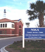
NOAA Coastal Services Center.
Neither the county nor the city has published this agreement.
No detail in the city’s agenda about the flood mapping, but
at the Lowndes County Commission
Work Session 11 November 2013
Emergency Services Director Ashley Tye said
the current agreement wouldn’t obligate any payment, merely to reserve the right to contract at a later date if that seemed to be in the county’s best interests,
and at the
Regular Session 12 November 2013
the county approved getting
LIDAR
data from
NOAA Coastal Services Center.
Neither the county nor the city has published this agreement.
Here’s the agenda: Continue reading