“Forests Dominate Georgia’s Land Use”
 That’s the title of slide 10 of 21 in
Center of Innovation – Energy (CIE)
by Jill Stuckey, Director.
Actually, massively pesticided planted pines dominate south Georgia’s land use;
not the same as actual forests with species diversity and diverse ages of trees.
The same CIE slide equates
Georgia Forestry = Biomass EnergyThat is what the state government seems to want it to be.
Back on slide 9, solar is defined as a southwestern regional energy source; nevermind that the solar map on that page shows Georgia with the same insolation as most of Texas (more on that later). And wind is defined as a central U.S. regional strength, nevermind that even Georgia Power has started exploring the possibility of wind off the Georgia coast.
I get it that Georgia has trees and forestry is a big industry in Georgia. I’m a tree farmer myself. I’d love to be convinced that biomass from trees is one good way to go. But at what costs? And compared to what?
The Georgia Forestry Commission (GFC) has a study showing locations of various kinds of trees throughout the state. Where’s the study relating that to potential biomass, wood pellet, and existing pulpwood and sawtimber plants? CIE slide 11 says
Twelve biomass to electricity projects have been announced in GeorgiaWhere are they? There’s a table in slide 17, but it seems to list only 10 sites (not 12), not including the proposed Wiregrass LLC Valdosta plant. One of them has “Waste (Chicken)” listed for “Feedstock”. For the others, the feedstock is listed as “Dirty Chips”, which is not what Oglethorpe Power says: they say they’ll burn whole trees. Let’s see the real fuels.
How big are they? The CIE table does list production megawatts per year, so that’s a start.
From how far around do they draw fuel (60 miles, 100 miles)? How does that affect the available wood sources? How do all the plants drawing on trees (sawmills, wood pellets, biomass, etc.) affect those wood sources? (CIE slide 17 lists two woood pellet plant, so that’s a start).
How long will it take for that wood to regrow? Let’s not pretend that burning a tree that took 15 or 50 years to grow is carbon neutral unless we figure in the time it takes for a new tree to grow.
Where’s the study showing all possible renewable energy sources for Georgia, including wind and solar? The CIE slides do also list some ethanol and biodiesel projects; that’s good. How does the land they use interact with the land used for trees for the biomass plants?
Where’s the study showing solar on housetops and business roofs, plus solar panel farms and mirror arrays?
Where’s the study showing wind farms off the coast and small windmills that can generate power during storms when solar doesn’t?
More importantly, where is the south Georgia or Georgia energy strategy showing all these current and potential sources of renewable energy, with restrictions or indications on where they can be used (parks, waterways, urbanized areas, etc.), potential energy generated, potential effects on woodstocks, agriculture, environment, etc.
This CIE is a good start.
 Where’s the rest of a Georgia Renewable Energy strategy?
Solar, wind, waves, tides, etc.?
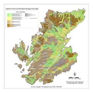
This is what a real renewable energy strategy looks like: Highland Renewable Energy Strategy. Where is the equivalent for Georgia? Right now, apparently there is none.
Short Link: