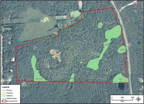
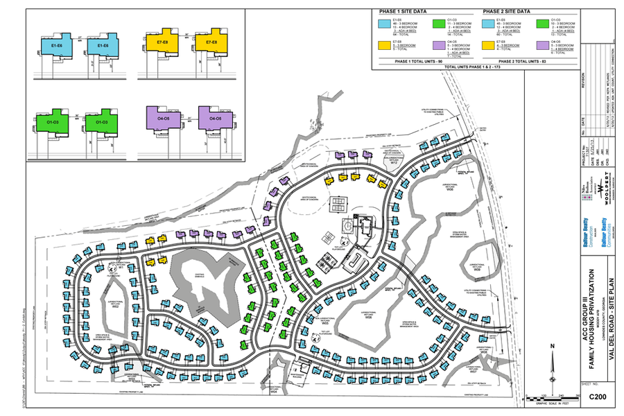
No geotechnical study was seen from the developer before drawing the sinkhole buffers shown in the the Air Force Draft Environmental Assessment for the proposed Moody Housing on Val Del Road, just rezoned as REZ-2013-09, PDF courtesy of Prof. Michael Noll of VSU. You can see sinkholes and wetlands in its maps:
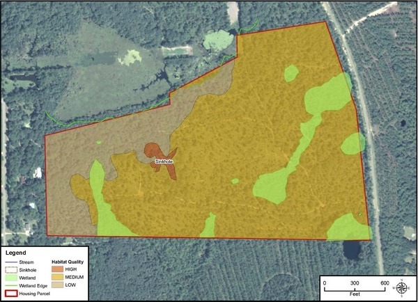
Most of the site area, including all of the Phase I area subject of REZ-2013-09, is colored for medium wetland habitat quality:
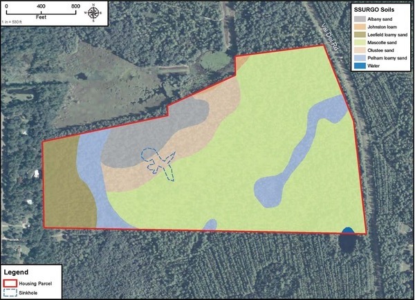
They included a soil map. Note the same soil as under the sinkhole underlies all of Phase I except the part that’s marked blue for water:
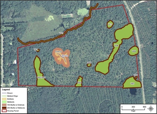
They do have tiny buffers marked around the sinkhole and even tinier ones around the wetlands:
 I wonder if that sinkhole will widen like that one
the county paid twice to fix on Snake Nation Road,
eventually moving the road to get away from it?
What will happen to all those housing units backed up against the
sinkhole and wetlands?
I wonder if that sinkhole will widen like that one
the county paid twice to fix on Snake Nation Road,
eventually moving the road to get away from it?
What will happen to all those housing units backed up against the
sinkhole and wetlands?
Makes you wonder what’s in that geotechnical analysis mentioned on page 4 and again on pages 4-13 and 6-2:
Soils and Geology. There may be a temporary increase in the potential for soil erosion during construction activities. However, this would be minimized through the implementation of NPDES/Lowndes County land disturbance permit-related requirements to mitigate soil erosion impacts from construction activities. The primary concern at the Val Del parcel is a sinkhole covering approximately 1.16 acres in the Phase II section of the site. The Project Owner will be required to obtain a Val Del Rd phase II site geotechnical report in accordance with local and state requirements on the suitability of the site for residential construction. Mitigation may include increased sinkhole buffer distances, or agreed upon phase II site re-configuration based upon business and engineering inputs. The Project Owner will make the Val Del Rd phase II site geotechnical report available to the Air Force and the Project Owner will comply with the recommendations included in such report. In order to begin Phase I, the developer would initially mitigate risk at the nearby Phase II area by establishing a 75-foot buffer around the sinkhole with a fence to prevent access to the area. Site designs would need to consider the development restrictions associated with poorly drained soils susceptible to wetness and flooding.
Page 4-14 makes it clear the sinkhole buffers shown in the maps were drawn before the Air Force saw any geotechnical study from the developer:
In order to begin Phase I, the developer would initially mitigate risk at the nearby Phase II area by establishing a 75-foot buffer around the sinkhole with a fence to prevent access to the area. This buffer was established through a literature review that considered how municipal and county governments typically mitigate risks associated with sinkholes prior to geotechnical study. The minimum recommended buffer identified in the text is 15 meters (approximately 50 feet) (Zhou & Beck, 2008). An additional 25 feet was added to the buffer based on visual inspection in order to enhance safety precautions until the sinkhole site has been assessed as described above.
You may wonder as I do what our County Commission is doing rezoning for a development next to a sinkhole before seeing such a geotechnical study.
-jsq
Short Link:
Pingback: Videos: Moody, Moody, acre, water, and SPLOST VII @ LCC 2013-08-13 | On the LAKE front
Pingback: VSU professors write to USAF consultant about Moody Family Housing @ LCC 2013-08-27 | On the LAKE front