That pipeline that starts in PCB-polluted Anniston, Alabama, where would it cross Lowndes County?
Two routes, one north to south, another from Brooks County southeast to the Florida line.
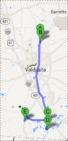
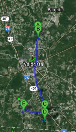
On this google map, A is the land mentioned in Massive pipeline project may cross Lowndes, by Jason Schaeffer, VDT, 30 June 2013, B, C, and D several of the parcels listed in the letters Sabal Trail Transmission LLC sent Lowndes County (another is very near D). They all form pretty much a straight line north to south. The actual route probably doesn’t go through downtown Valdosta; that’s just where google maps guesstimated road directions. Where does would it go? We don’t know. Maybe we should.
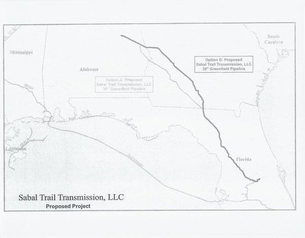
And E is the location from the slightly later letters to Lowndes County that included the map with two path options. E appears to be on the path of Option A while A-D are on the path of Option B. And Option A on the map seems to come in from Brooks County, which explains why I hear a lawndowner in Brooks County say he also got such a letter.
Maybe some of our elected or appointed officials could do this exercise and plot these paths for us? Maybe they could even insist that Sabal Trail Transmission publish a real map showing the actual proposed paths?
-jsq
Short Link: